Integrating Map Tiles with QGIS
Integrating Map Tiles with QGIS
QGIS is a GIS desktop software that provides exceptional cartographic design features to craft outstanding maps for desktop, mobile, cloud, and print media. It has state-of-the-art analysis tools seamlessly integrated into the toolbox. QGIS also supports map tiles that use an API familiar to those provided by strues-maps.lt. Below, you can find setup information for importing our map data into QGIS, a spatial analysis software. Also, strues-maps.lt indirectly uses OpenStreetMap data, which requires copyright attribution. The setup information is intended for QGIS version 3.44, released in June 2025.
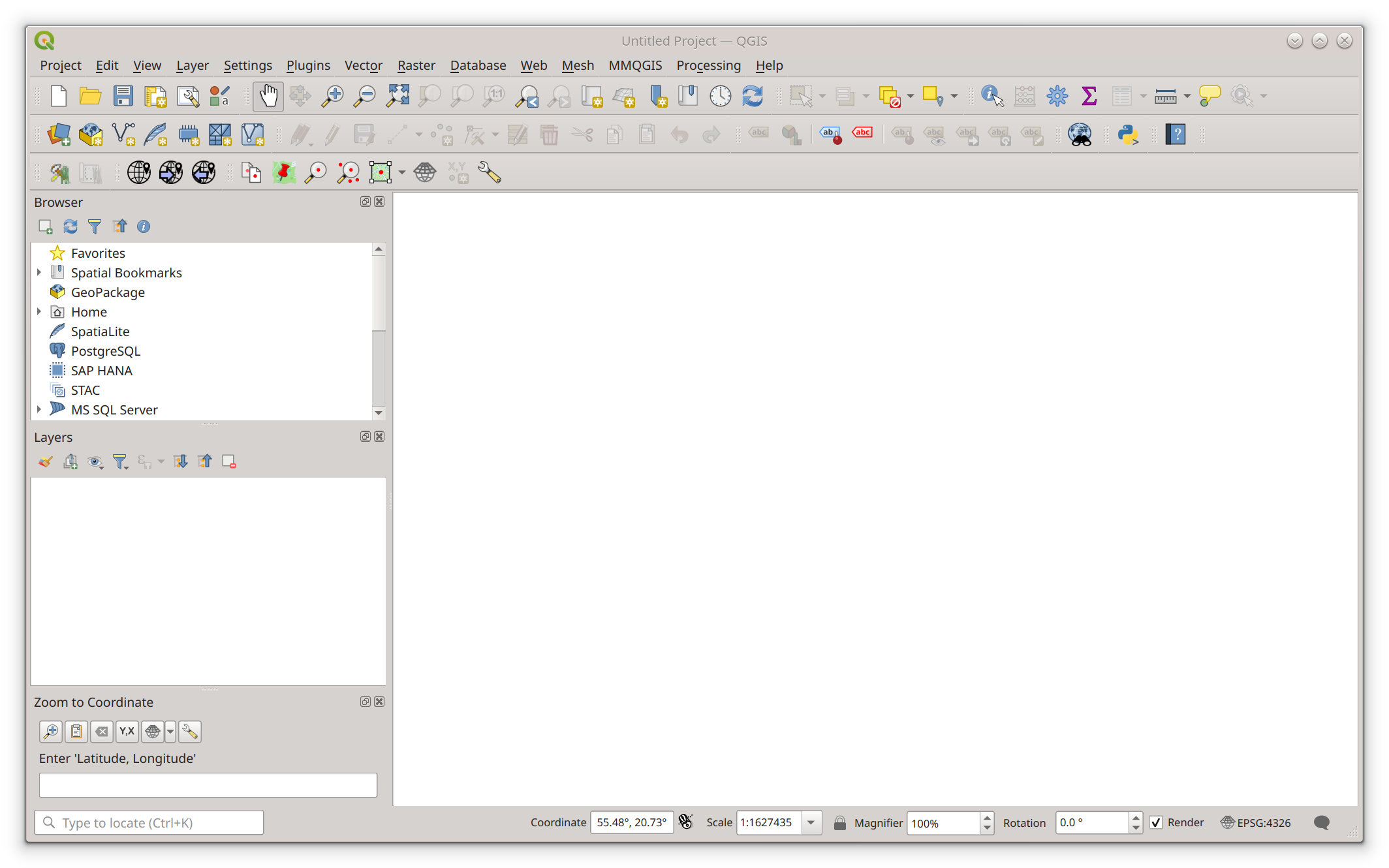
Create a new project
Launch the QGIS application using the desktop icon or start menu, then create a new project
by selecting [Project] -> [New] from the main navigation.
Add the XYZ layer
Activate the new layer dialog by selecting [Layer] -> [Add layer] -> [Add XYZ layer] from the main menu.
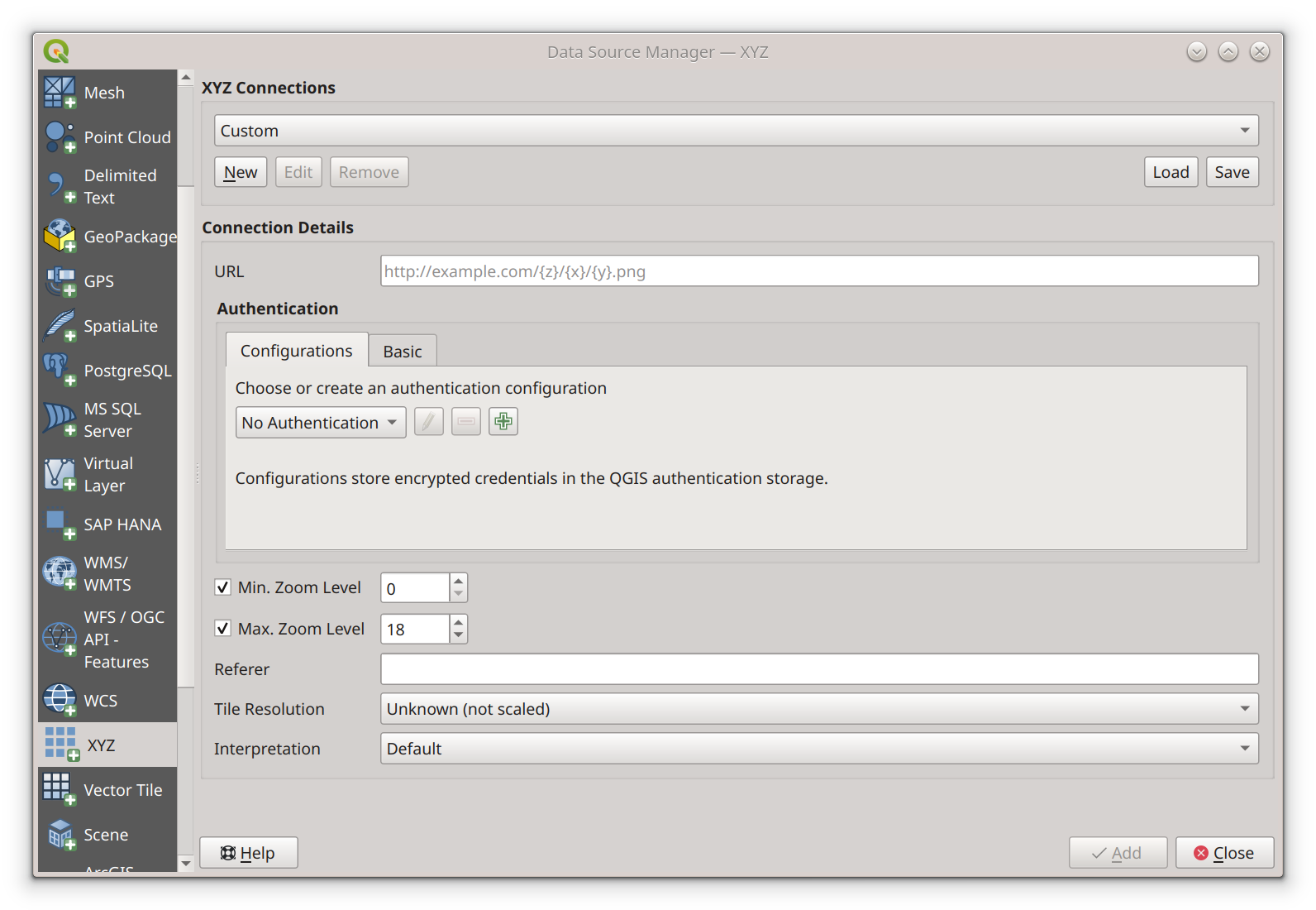
Configure XYZ layer
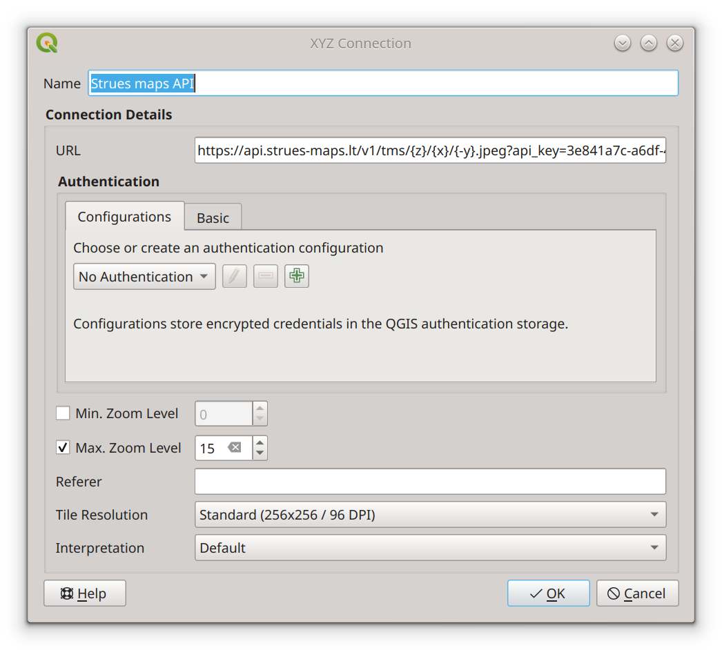
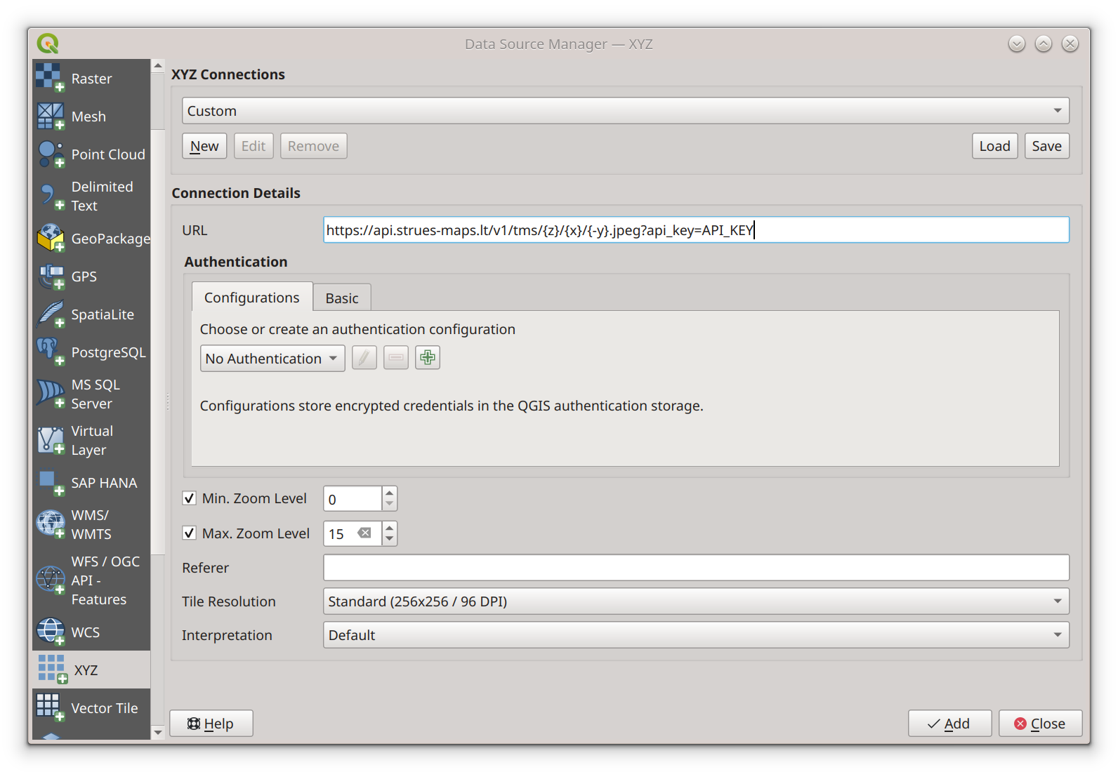
In the "XYZ Connections" group, click the "New" button. A pop-up window will appear. In the Name field,
enter "Strues maps API". In URL field : "https://api.strues-maps.lt/v1/tms/{z}/{x}/{-y}.jpeg?api_key=API_KEY".
Instead of text API_KEY, enter the api key you received after registration. Set Min. Zoom Level at 0. Set Max.
Zoom Level at 15. Set Tile Resolution at 256x256 pixels. Click the button "Ok".
 At this point, the data source configuration window will close, and the "XYZ Connections" group will have
"Strues maps API" selected. Click the [Add] button to add a layer to the Layers list. Click the [Close]
button to close the layers dialog. At this point, the Baltic States will be invisible and will require
the user to zoom to some coordinates on the map.
At this point, the data source configuration window will close, and the "XYZ Connections" group will have
"Strues maps API" selected. Click the [Add] button to add a layer to the Layers list. Click the [Close]
button to close the layers dialog. At this point, the Baltic States will be invisible and will require
the user to zoom to some coordinates on the map.
Install the "Lat Lan Tool" plugin
Activate the plugin installation window from the main navigation by clicking [Plugins] -> [Manage and install plugins].
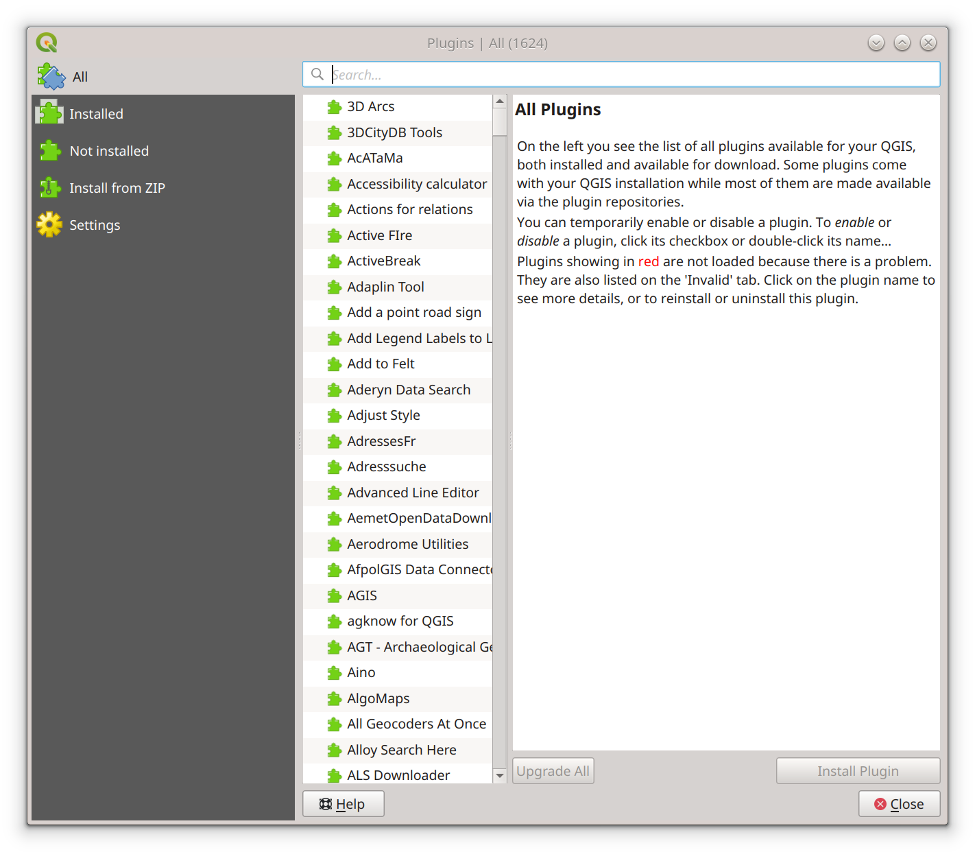
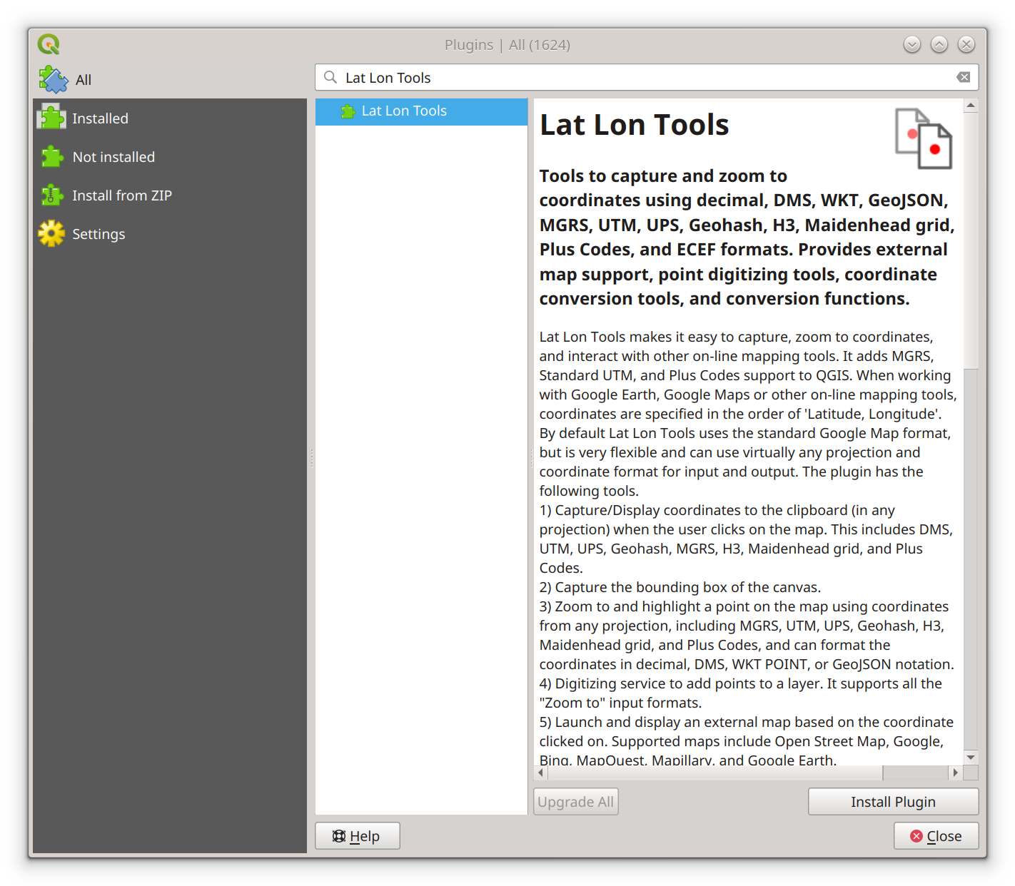
In the Plugins window search field, enter "Lat Lon Tools". Select "Lat Lon Tools" from the plugin list that
matches your search criteria. Click the [Install plugin] button.
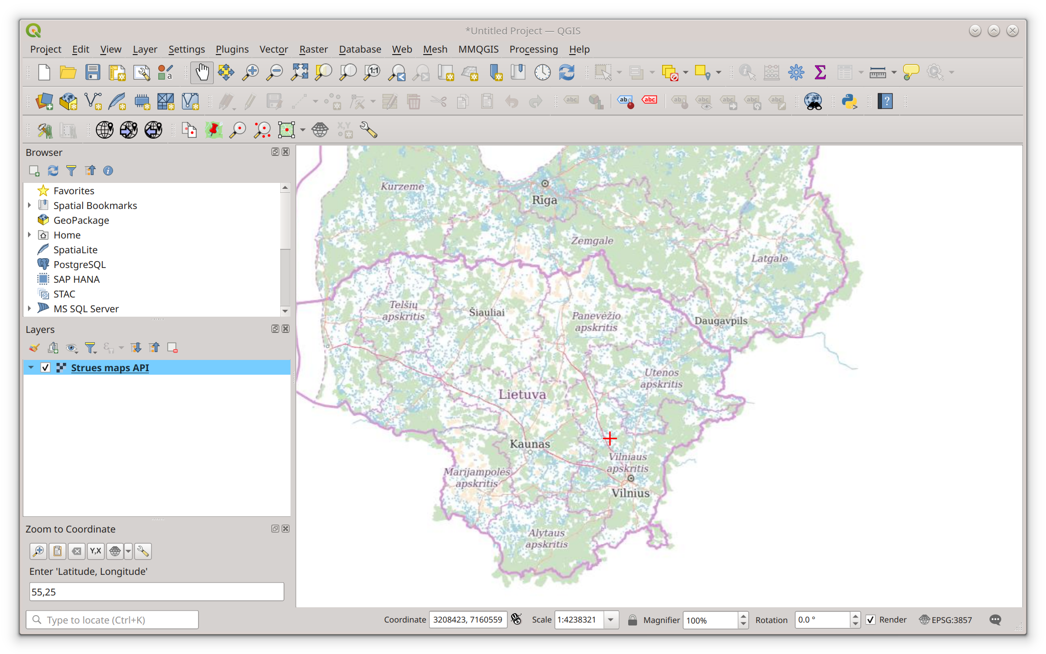
Activate the "Lat Lan Tool" window from the main menu. Click [Plugins] -> [Lat Lan Tool] -> [Zoom to coordinate].
In the field "Enter Latitude, Longitude", enter "55,24" which will point somewhere in the Baltic States. At this
point, a red cross will appear on the screen. Point the mouse cursor somewhere near it and scroll a bit. This will
make the Baltic States look larger, until you will be able to see separate houses.
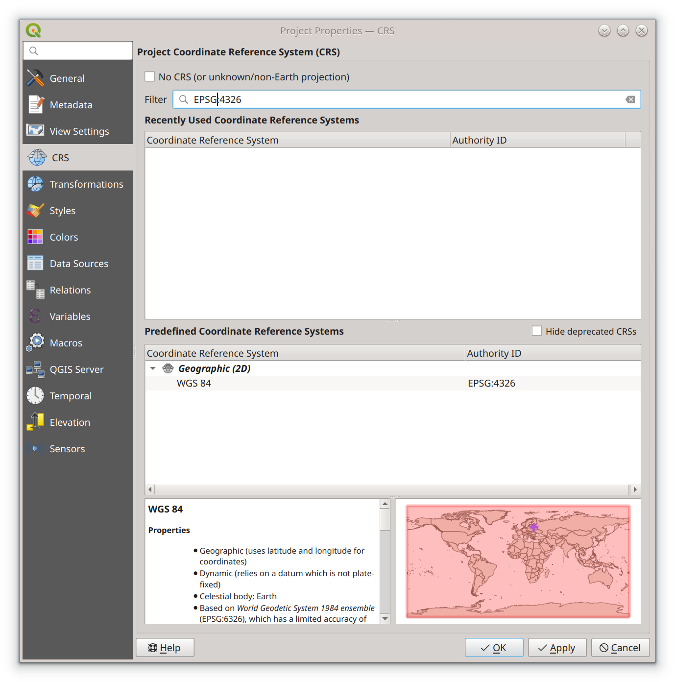
Choosing a coordinate reference system
In case the map looks distorted, select an EPSG:3857 coordinate reference system in the bottom right corner.
Click on the [EPSG:xxxx] button in the bottom right corner. In the Filter field, enter "3857". In the
"Predefined Coordinate Reference Systems" list, select the EPSG:3857 and click the [OK] button. At this
point, the dialog should close, and the map should appear in the new coordinate reference system.